Brantford Routing by map
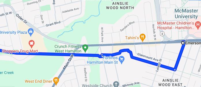
We depart from Mcmaster University Bike Share hub that faces Main Street and enter the rail trail via Emerson St.
We may slow down in this portion to allow others to catch up as there are a few turns to reach the main rail trail.
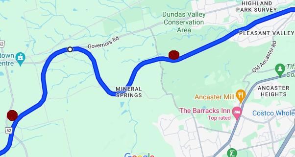
We start music at this point. This leg of the journey is easy to follow but feels a tiny bit hilly over a stretch of 10 km. We'll take brief breaks at the Dundas Trail Center and the Summit Bog. (shown as red circles on the map).
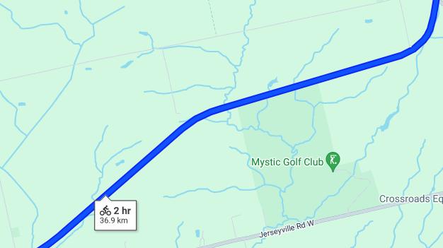
This next 6 km stretch is long one, but it will be a breeze as its a slight downhill. If you can operate your bike correctly, you could go in excess of 40km/h! We then cross Field Rd
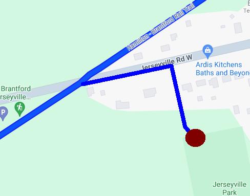
After field road, we arrive at Jerseyville road where we turn into town then right on a dirt driveway into the park. We stop at the nearest picnic table in the park for a 20-minute or so lunch, then we continue on the rail trail.
When we arrive close to the highway, we will go downhill, under the bridges, then we'll take a break at the top of the hill to wait for any others to catch up.
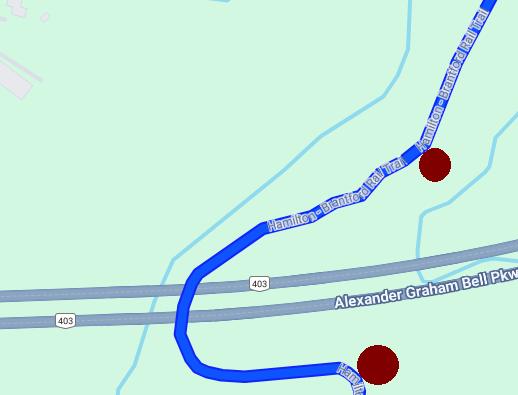
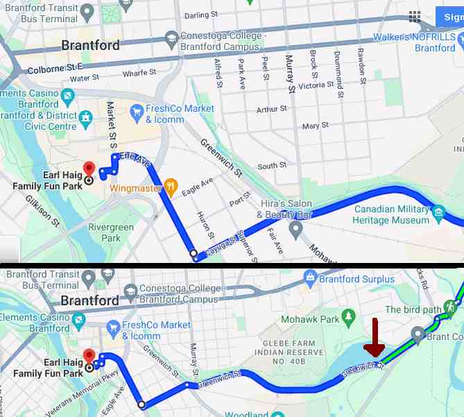
We will eventually arrive to Locks St and cross it, then we take the trail alongside Mohawk Rd. The red arrow is where we complete the trip by road. We will go down Greenwich street at high speed until we come to an intersection. We'll take the side street, cross the tracks, and go downhill to Erie Ave. Finally, we turn right and follow the road out to Earl Haig Waterpark.
Donations and Inquiries
If you have any questions or you want to make a donation, you may send an email to us at our email address shown in the box below.